
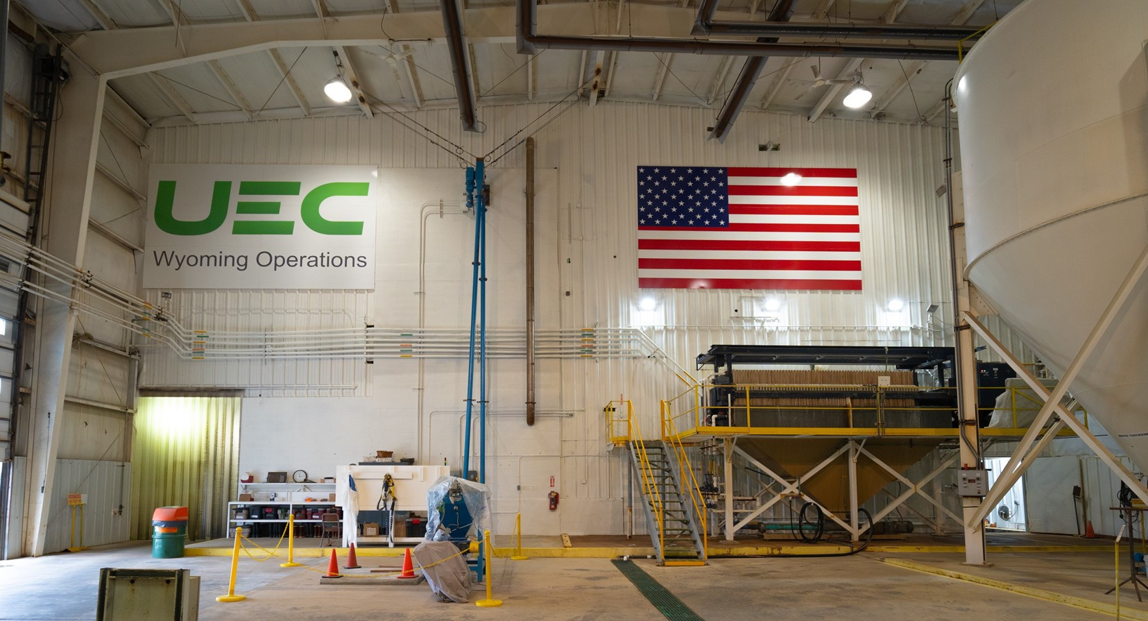
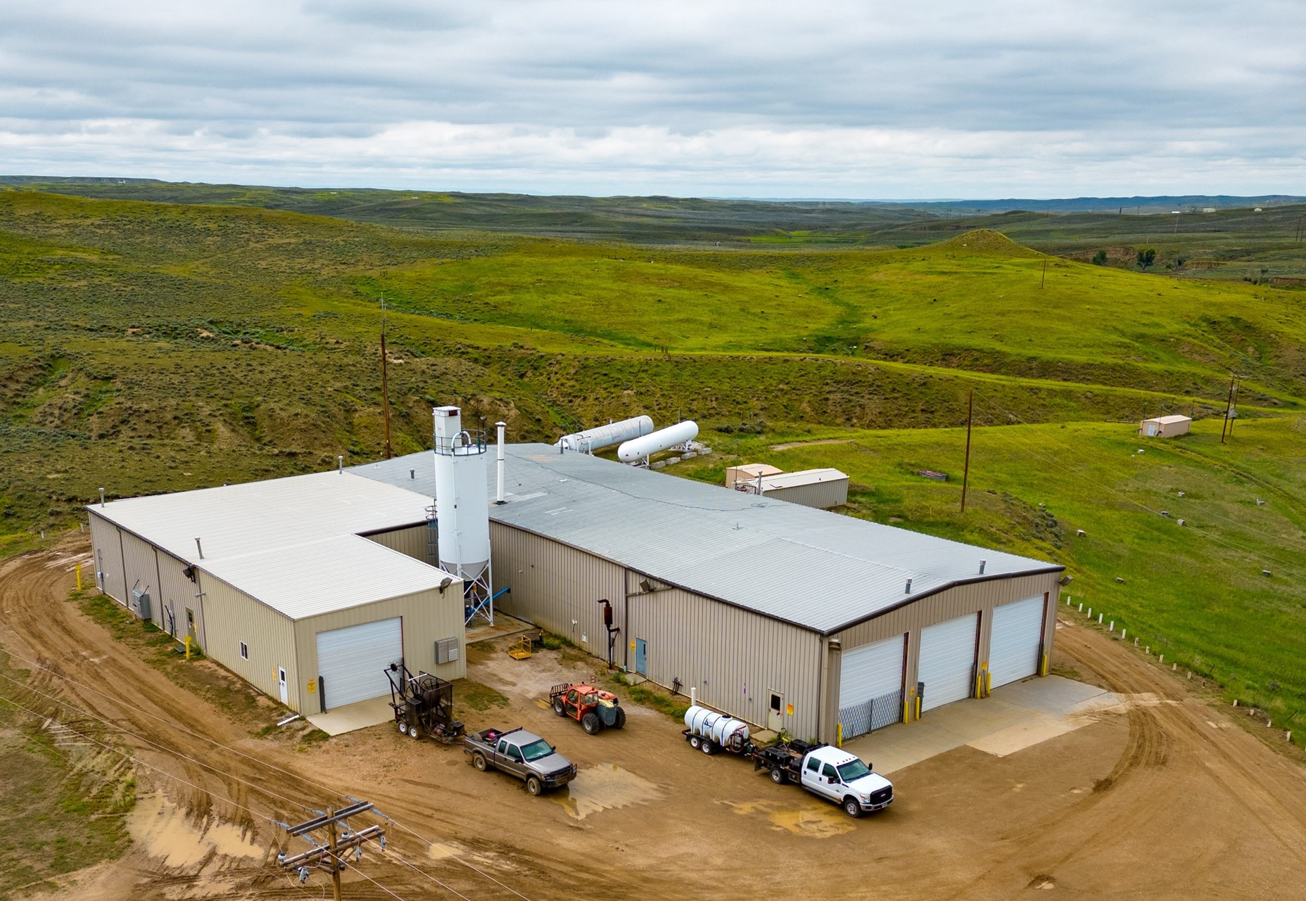
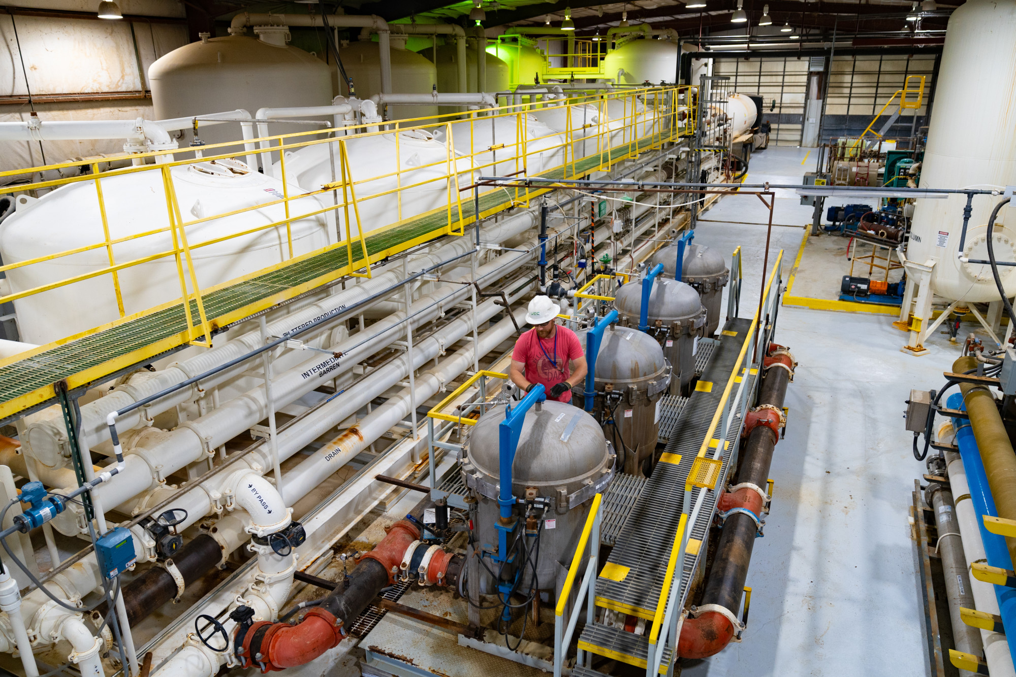
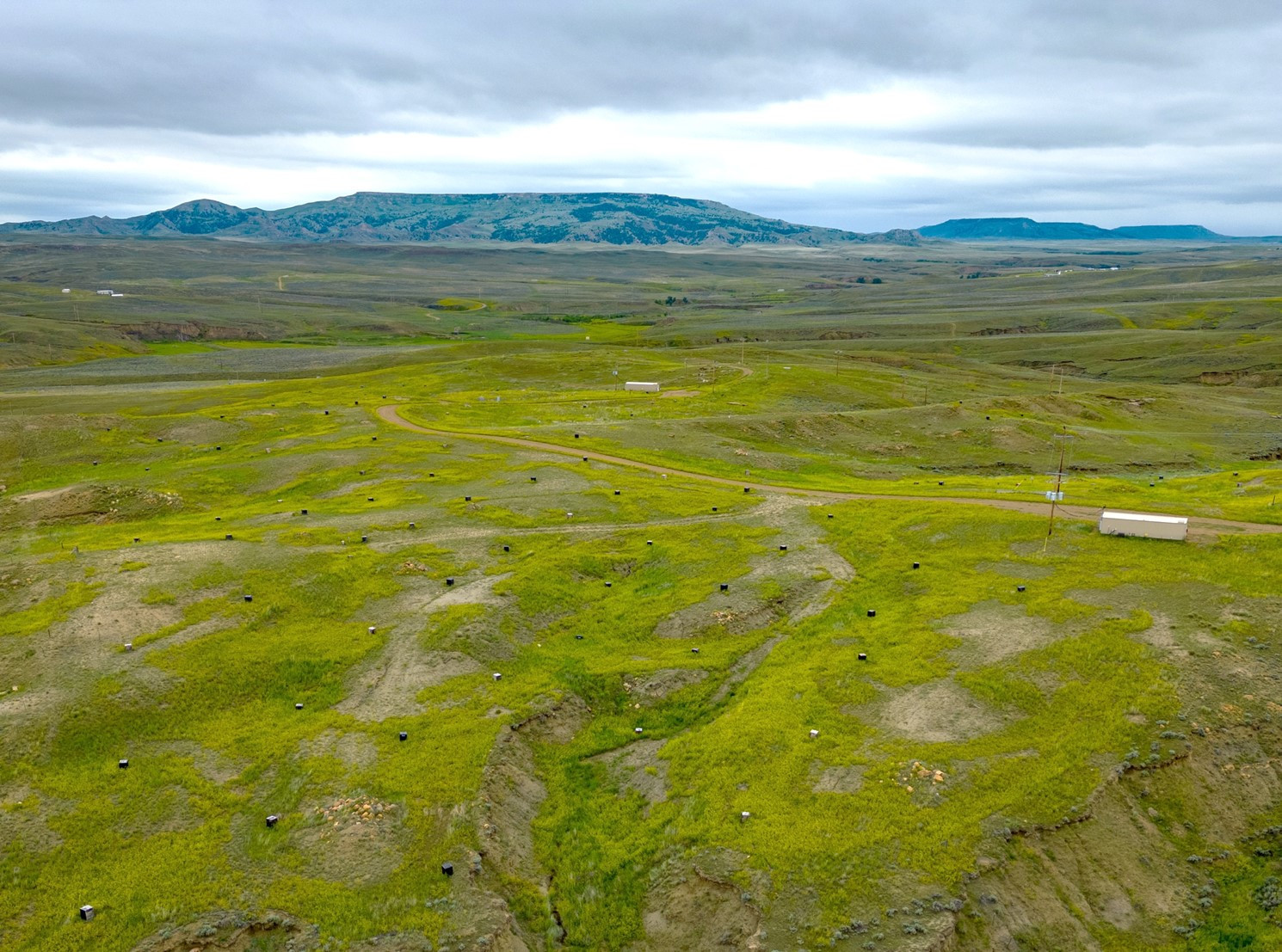
Wyoming
Wyoming
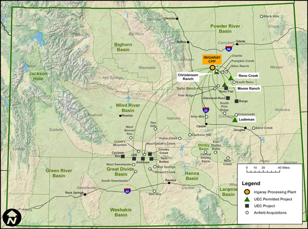
- Irigaray Hub & Spoke Operations
- Sweetwater Hub & Spoke Operations
- Resource Disclosure
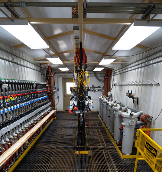
- Photo Gallery
- Careers
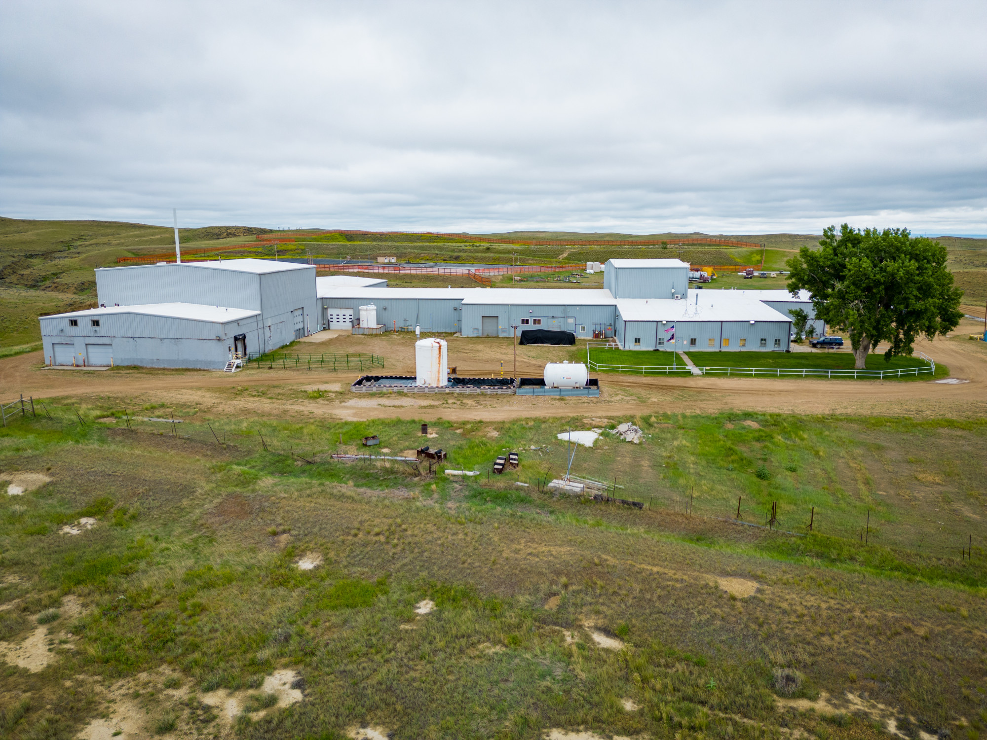
- UEC restarted operations at the Christensen Ranch ISR operation in August 2024
- Irigaray Central Processing Plant (CPP) is the Hub to satellite In-Situ Recovery (ISR) projects across the Powder River Basin (“PRB”), with 11 Project areas (Spokes), four of which are fully permitted projects.
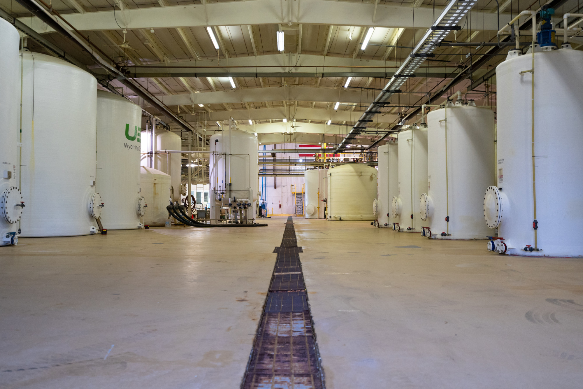
- Key production milestone achieved at Irigaray CPP with first drummed uranium concentrate in February 2025
- 4 Million pounds per year of licensed production capacity
- S-K 1300 Technical Report Summary filed on September 15, 2022 positioned UEC with the largest S-K 1300 reported uranium resources in the U.S; 66.2 Million lbs. of Measured and Indicated resources with another 15.1 Million lbs Inferred
- Sweetwater Project Designated by U.S. Government for Fast-Track Permitting to add in-situ recovery capability, creating the largest dual-feed uranium facility in the U.S. in August 2025
- UEC acquired 100% of Rio Tinto's Wyoming assets, comprised of the fully-licensed Sweetwater Plant and adding 175 million pounds of historic resources
- 8 more permitted and exploration stage projects added to UEC’s 12 existing ISR projects, creating UEC’s 2nd Hub and Spoke production platform in Wyoming
- 4.1 Million pounds per year of licensed production capacity
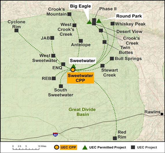
Uranium Energy Corp Completes Acquisition of Rio Tinto's Sweetwater Plant and Wyoming Uranium Assets
Table 1 - Project Area Measured and Indicated Resources Summary
| Mineral Resource | GT Cutoff | Average Grade % eU3O8 |
Ore Tons (000s) | eU3O8 (lbs) |
| Allemand-Ross | ||||
| Measured | 0.25 | 0.085 | 246 | 417,000 |
| Indicated | 0.25 | 0.066 | 32 | 42,400 |
| Total Measured and Indicated | 0.25 | 0.083 | 278 | 459,400 |
| Barge | ||||
| Measured | N/A | N/A | 0 | 0 |
| Indicated | 0.25 | 0.051 | 4,301 | 4,361,000 |
| Total Measured and Indicated | 0.25 | 0.051 | 4,301 | 4,361,000 |
| Charlie | ||||
| Measured | N/A | N/A | 0 | 0 |
| Indicated | 0.2 | 0.123 | 1,255 | 3,100,000 |
| Total Measured and Indicated | 0.2 | 0.123 | 1,255 | 3,100,000 |
| Christensen Ranch | ||||
| Measured | N/A | N/A | 0 | 0 |
| Indicated | 0.25 | 0.073 | 6,555 | 9,596,000 |
| Total Measured and Indicated | 0.25 | 0.073 | 6,555 | 9,596,000 |
| Clarkson Hill | ||||
| Measured | N/A | N/A | 0 | 0 |
| Indicated | N/A | N/A | 0 | 0 |
| Total Measured and Indicated | N/A | N/A | 0 | 0 |
| Irigaray | ||||
| Measured | N/A | N/A | 0 | 0 |
| Indicated | 0.25 | 0.076 | 3,881 | 5,899,000 |
| Total Measured and Indicated | 0.25 | 0.076 | 3,881 | 5,899,000 |
| Jab/West Jab | ||||
| Measured | 0.25 | 0.072 | 1,621 | 2,335,000 |
| Indicated | 0.25 | 0.077 | 253 | 392,000 |
| Total Measured and Indicated | 0.25 | 0.073 | 1,874 | 2,727,000 |
| Ludeman | ||||
| Measured | 0.25 | 0.094 | 2,674 | 5,016,900 |
| Indicated | 0.25 | 0.088 | 2,660 | 4,696,900 |
| Total Measured and Indicated | 0.25 | 0.091 | 5,334 | 9,713,800 |
| Moore Ranch | ||||
| Measured | 0.3 | 0.06 | 2,675 | 3,210,000 |
| Indicated | N/A | N/A | 0 | 0 |
| Total Measured and Indicated | 0.3 | 0.06 | 2,675 | 3,210,000 |
| Nine Mile | ||||
| Measured | N/A | N/A | 0 | 0 |
| Indicated | N/A | N/A | 0 | 0 |
| Total Measured and Indicated | N/A | N/A | 0 | 0 |
| Red Rim | ||||
| Measured | N/A | N/A | 0 | 0 |
| Indicated | 0.25 | 0.17 | 337 | 1,142,000 |
| Total Measured and Indicated | 0.25 | 0.17 | 337 | 1,142,000 |
| Reno Creek | ||||
| Measured | 0.2 | 0.043 | 14,990 | 12,920,000 |
| Indicated | 0.2 | 0.039 | 16,980 | 13,070,000 |
| Total Measured and Indicated | 0.2 | 0.041 | 31,970 | 25,990,000 |
| Project Totals | ||||
| Measured | 22,206 | 23,898,900 | ||
| Indicated | 36,254 | 42,299,300 | ||
| Total Measured and Indicated | 58,460 | 66,198,200 | ||
Notes:
- Sum of measured and indicated tons and pounds may not add up to the reported total due to rounding.
- Measured and indicated mineral resources as defined in 17 CFR § 229.1300.
- Resources are reported as of December 31, 2021.
- All reported resources occur below the static water table.
- The point of reference for mineral resources is in-situ at the Project.
- Mineral resources that are not mineral reserves do not have demonstrated economic viability.
Table 2: - Project Area Inferred Resources Summary
| Mineral Resource | GT Cutoff | Average Grade % eU3O8 | Ore Tons | eU3O8 |
| (000s) | (lbs) | |||
| Allemand-Ross | ||||
| Inferred | 0.25 | 0.098 | 1,275 | 2,496,000 |
| Barge | ||||
| Inferred | N/A | N/A | 0 | 0 |
| Charlie | ||||
| Inferred | 0.2 | 0.12 | 411 | 988,000 |
| Christensen Ranch | ||||
| Inferred | N/A | N/A | 0 | 0 |
| Clarkson Hill | ||||
| Inferred | 0.2 | 0.058 | 957 | 1,113,000 |
| Irigaray | ||||
| Inferred | 0.25 | 0.068 | 104 | 141,000 |
| Jab/West Jab | ||||
| Inferred | 0.25 | 0.06 | 1,402 | 1,677,000 |
| Ludeman | ||||
| Inferred | 0.25 | 0.073 | 866 | 1,258,000 |
| Moore Ranch | ||||
| Inferred | 0.3 | 0.047 | 46 | 43,700 |
| Nine Mile Lake | ||||
| Inferred | 0.25 | 0.036 | 3,405 | 4,308,000 |
| Red Rim | ||||
| Inferred | 0.25 | 0.163 | 473 | 1,539,000 |
| Reno Creek | ||||
| Inferred | 0.2 | 0.039 | 1,920 | 1,490,000 |
| Project Inferred Totals | ||||
| Inferred | 10,859 | 15,053,700 | ||
Notes:
- Sum of inferred tons and pounds may not add up to the reported total due to rounding.
- Inferred mineral resources as defined in 17 CFR § 229.1300.
- Resources are reported as of December 31, 2021.
- All reported inferred resources except Jab/West Jab occur below the static water table. The inferred resources at Jab/West Jab occur above the water table and may not be amenable to ISR.
- The point of reference for mineral resources is in-situ at the Project.
- Mineral resources that are not mineral reserves do not have demonstrated economic viability.
Summary capital and operating cost estimates are not included with the TRS since the Company is reporting the results of an initial assessment.
The technical information in this news release has been reviewed by WWC Engineering, a consultant to the Company, and by Dayton A. Lewis, P.G., Vice President Resource Development – Wyoming, for the Company, being a qualified third party firm and a Qualified Person under Item 1302 of Regulation S-K.
Wyoming Project Gallery
Wyoming Careers
UEC is an active energy resource company seeking to fill multiple full-time positions for upcoming operations at the Christensen Ranch and Irigaray (“Willow Creek”) in-situ recovery uranium projects in Johnson and Campbell counties, Wyoming. Positions are also available in our Casper, Wyoming office. UEC is an equal opportunity employer, offering competitive salaries and a robust benefit package (including health, dental, vision, short and long term disability, life insurance), generous PTO, and 401K Plan with Company match.
To apply for any of the above positions, send your resume and qualifications to: [email protected].